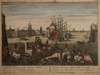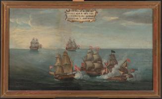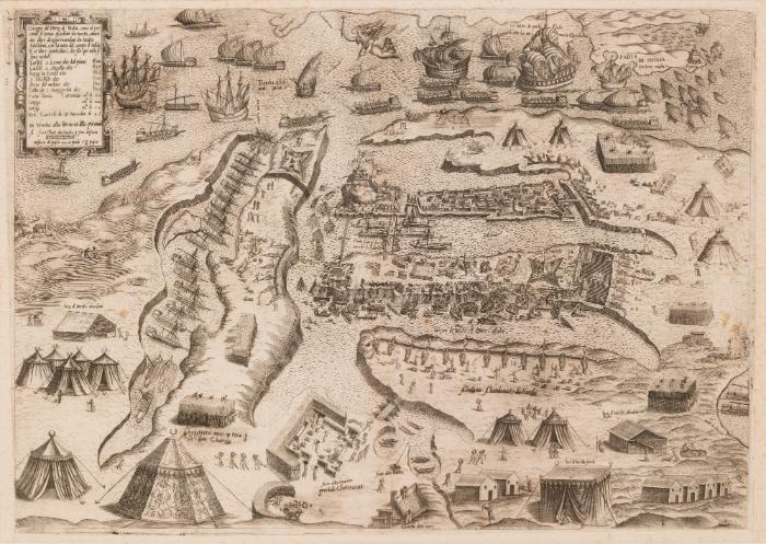
Disegno del Porto di Malta
Alternate title
- Great Siege Map
Artist
Giovanni Francesco Camocio
Italian, 1501 - 1575
DateEarly October 1565
Period16th century
Classification(s)
Object TypeMap
Registration NumberFAS/MAPS/41
DescriptionProduced in Venice by Giovanni Francesco Camocio, this is one of four maps that represents the final phases of the Great Siege of Malta in 1565. This map, the third state, represents the arrival in September 1565 of the Gran Soccorso which consisted of the Catholic Armada. This was the turning point leading to the surrender of the Ottoman Turks to the Order of St John. These maps quickly spread the news of the goings-on of the Siege. They were derived from illustrated war reports sent from Malta. The first, third and fourth states of the Great Siege map series form part of MUŻA’s Cartographic Collection, while the second state belongs to the Map Collection of the Faculty of Science at Charles University in Prague, Czech Republic. These two institutions collaborated to successfully include these four maps in UNESCO’s International Memory of the World Register, an honour achieved in 2017.Special CollectionAlbert Ganado Malta Map Collection (AGMMC)
MaterialBlack ink on laid paper
TechniqueEtching
Place of ManufactureVenice
DimensionsPlatemark: 32.5 x 46 cm
Support: 55 x 69.5 cmProvenanceAcquired in 2008 from the Albert Ganado Malta Map Collection.Alternate ID Numbers
- Inventory Card 30215-6
- HM Object Number 50608
Online Collections
Public Access
On viewMuseumMUŻA
Location
- MUŻA, First Floor, Baroque: 1530-1798, The Order of St John