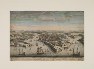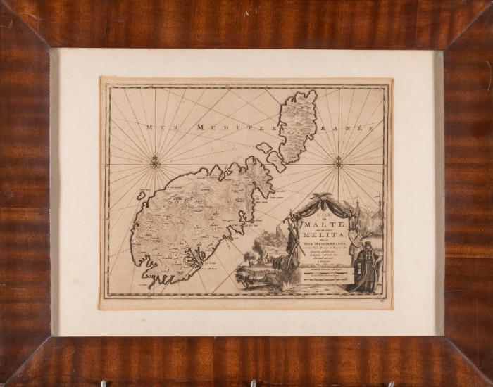
L'Ile de Malte anciennement Melita dans la Mer Mediterranee, avec ses Villes, Bourgs et Bayes
Alternate title
- Map of Malta
Publisher
Pierre Vande Aa
1659 - 1733
Classification(s)
Object TypeEngraving
Registration NumberFAS/MAPS/8
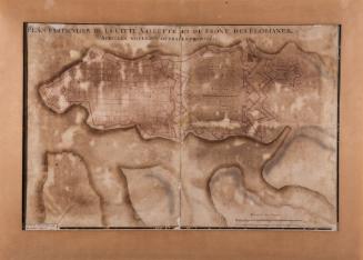
DescriptionAn engraving on paper mounted on wooden board and framed with white passpartout in a wooden commercial frame behind glass. This map has detailed place names. The orientation of this map is towards the west with coordinates placed around the border of the map. The map's title is within a cartouche. The latter is surrounded by various scenes, including St. Paul's shipwreck and a naval battle. This map was printed from the plate published in Graevius (map 152), but now numbered '36.' in ink at bottom-right corner.The map was published by Pieter van der Aa (1659-1733), a Dutch publisher known for the production of maps and atlases. In addition to this, he is known for publishing pirated editions of foreign works. He worked in Leiden, the Netherlands and eventually became the leading printer of the city and the university.InscriptionsOn recto "Mer Mediterranee L'Ile de Malte, anciennement Melita, dans la Mer Mediterranee, avec ses Villes, Bourgs et Bayes, de nouveau publiee par Pierre Vander Aa, Marchand Libraire a Leide. Lieues de France de 20 au Degre. Lieues d'Italie de 60 au Degre". Also contains inscriptions on the map with the names of towns and villages, the scale on the perimeter and number "36" at the bottom right-hand corner. On verso in blue ink "FAS/MAPS/8 15134-5".Material
Parchment; ink; wood.
TechniqueEngraving black ink on parchment. Mahogany decorative frame.
Dimensions49.4 x 62.7cm (framed); 28 x 36.5cm (unframed)Alternate ID Numbers
- Inventory Card 15135-6
- HM Object Number 80550
- Register Book Number 36
- EEA Norway Grant EEA.1660
Public Access
Not on viewMuseumMalta Maritime Museum
Location
- Reserve Collection
MMM 000944
ca. 1870
Art / Prints