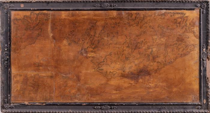
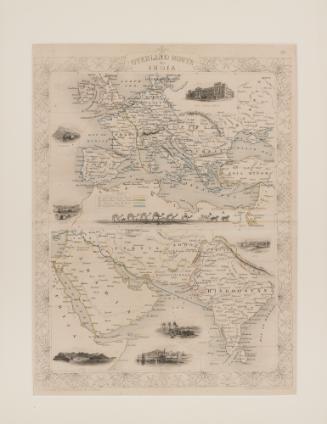
Map of Malta and Gozo with insert bottom left of Grand Harbour
Publisher
Edward Goodenough
DateMay 1854
Period19th century
Classification(s)
Object TypeLithograph
Registration NumberMMM 004827
InscriptionsOn recto, there are various inscriptions, including title "Plan of Valletta and its Harbours" and note "This Geological Chart of the Island of Malta was presented to the Publisher by the Right Hon. The Earl of Ducie. And he is further indebted to other scientific gentlemen for the plans of Gozo and of the City of Valletta, and its suburbs as also for valuable additions of Roads, Light Houses & of the latest construction. Published by Edmund Goodenough, Stationer & c. 252, Strada Reale, and 301, Strada San Paolo, La Valletta, Malta. May 1854". Other inscriptions include a legend for the various rock formations of the Maltese islands, as well as the names of towns and harbours on the map itself.Annotations and MarksOn recto, on decorative frame, top member a yellowed label reads "1".TechniqueLithograph attached to a wooden board. Carved and painted decorative frame.
Dimensions73 x 136cm (framed); 60 x 121cm (unframed)Alternate ID Numbers
- HM Object Number 81333
- EEA Norway Grant EEA.2130
- Inventory Card 40363-4
- Other HM Registration Number FAS/MAPS/11 (Card 16107-8)
Public Access
Not on viewMuseumMalta Maritime Museum
Location
- Reserve Collection


EEA9043-01-078
Photography